巻1:日本総図(vol1: outline map of Japan):日本海(Sea of Japan)
(stored in Washeda Univ. Library)
1888:青木恒三郎 分邦詳密日本地図
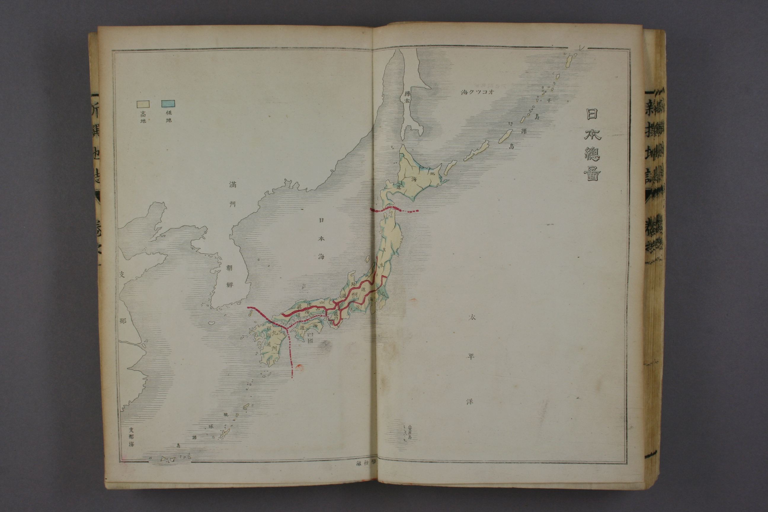
1888:青木恒三郎 分邦詳密日本地図 ;日本海(Sea of Japan)
http://kindai.ndl.go.jp/info:ndljp/pid/767761/7
Btw, Korean media distorts there are Ulleungdo and Liancourt Rocks(=Takeshima) on this map, is wrong
http://www.munhwa.com/news/view.html?no=2012082801030143186004
It is appear that the two island in the sea of Japan, one is Argonaut island and the other is Dagelet-Ulluengdo and It is not Liancourt Rocks on this map.
https://sites.google.com/site/takeshimaliancourt/Home/Korean-media-black-propaganda/20120828
Google Earth Argonaut-Dagelet-Liancourt Rocks Position check tool; (download; no virus)
Moreover, there are many Japanese map on Meiji era which describes Liancourt Roocks(Takeshima).


