Korea Digital Archives Library
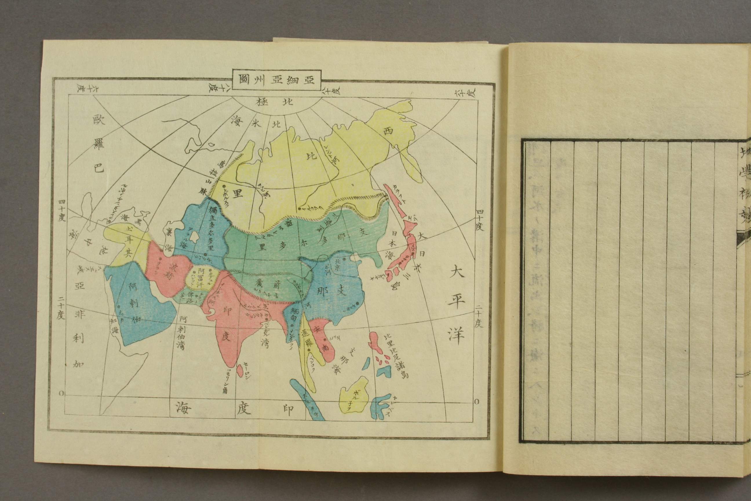
上 亜細亜 地理 位置 (Location and geography in Asia)
二 海岸 2:Coastalarea
亜細亜●海岸線●欧羅巴・・・・・省略
一 北極洋●側
二 太平洋●側
...省略.....西方樺太島●本陸間●在●韃靼海峡●過●●日本海●南下
○○朝鮮海峡●過●黄海●入●●・・・・・・
(2. Pacific ocean side ..........West Sakharin island, Tatar Strait..after that Sea of Japan....Strait of Korea, after that Yellow Sea.

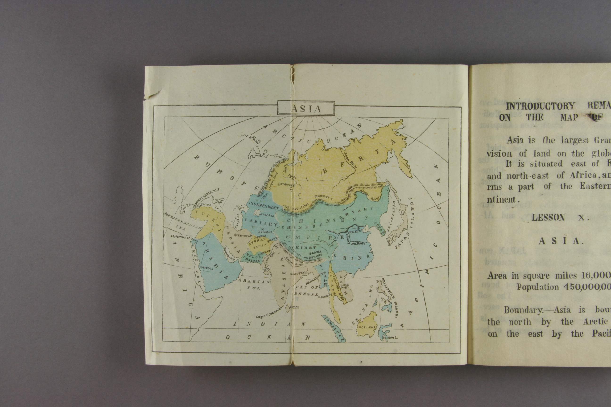
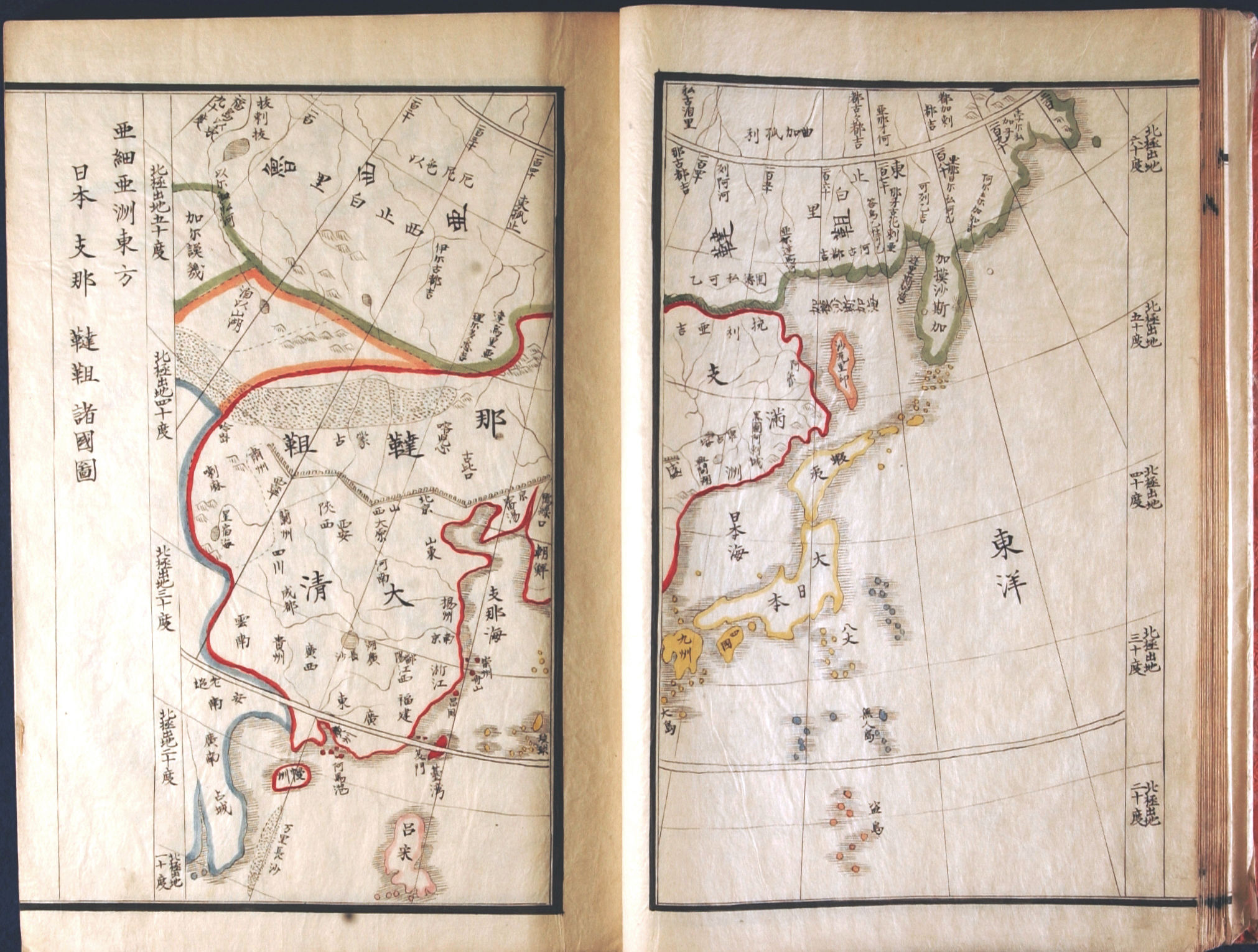
第二章 日本 P32(N36)
二 境域 日本X四面X 海XX伊賀氏X沙XX北太平洋XX北亜米利加州X向XX北X千島海峡X隔てるX露領XXXXXX半島X接XX宗谷海峡XXXX露領からふと島X対XX西X滞水X朝鮮海峡X隔XX朝鮮半島X向X台湾海峡XXXX清国福建省X隔XX?島XX三個弓型X成XXXXXX海X日本海及東海水X擁XXX南X XX海峡........

Thw description on P32 Donghae means East China sea, It can confirmed another related page as follows
P33/N37 P36/N40 there are the description of East Sea (It means East China Sea)
P36/N40 there are the description of East Sea (It means East China Sea)

1909.1910.
(新訂)中等萬國新地志 金鴻卿 編纂 廣學書館
Korea National Digital Archives Library
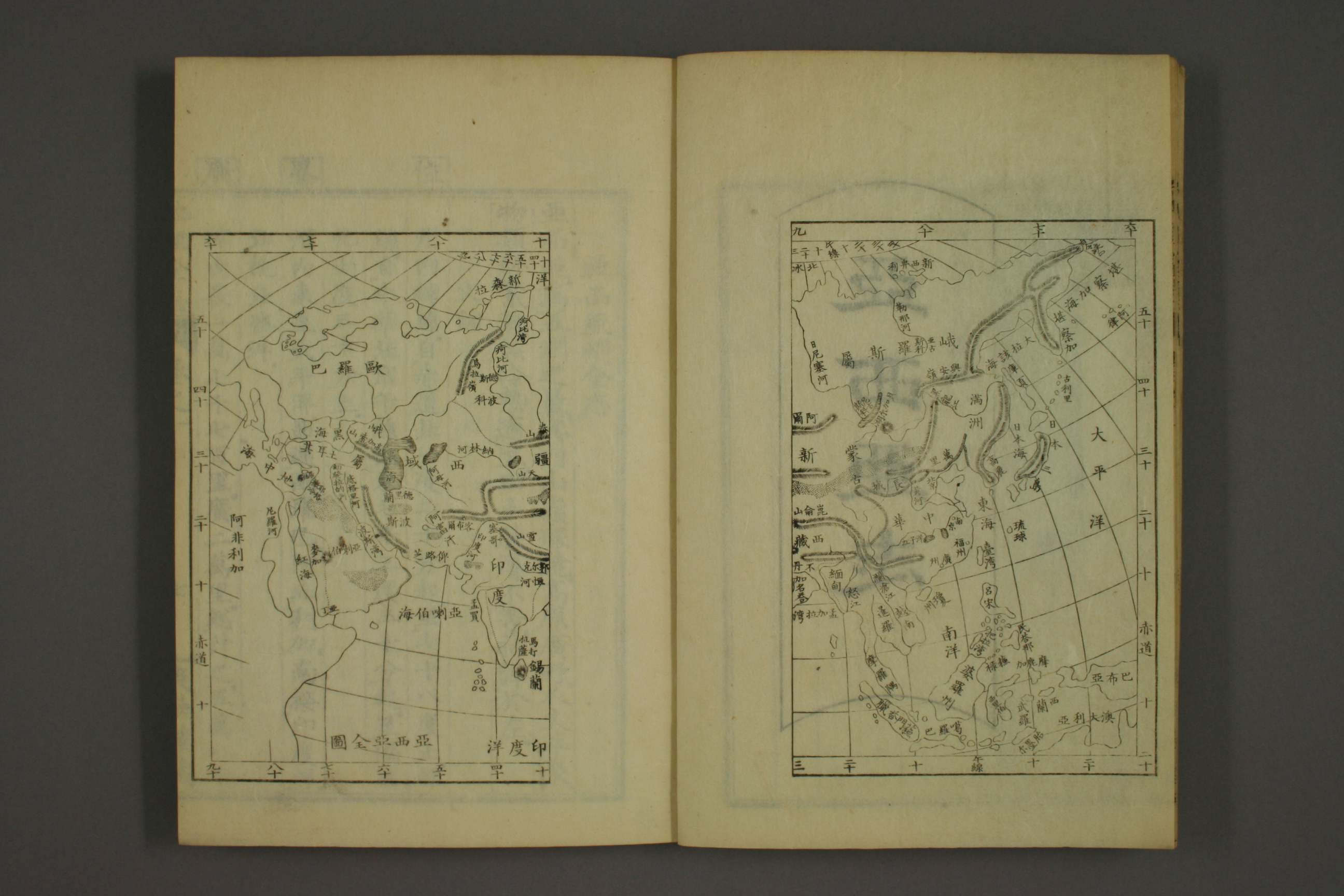
第二章 亜細亜 (1909/1910 same)
第一節 総論
沿海 P52
日本海、黄海、 朝鮮海(別称蒼海)、支那海
..............................................................................
右諸海中、北氷洋 舟編 不通●●●●海●●●日本海.....
%E4%B8%AD%E7%AD%89%E8%90%AC%E5%9C%8B%E6%96%B0%E5%9C%B0%E5%BF%97.jpg)
第三節 日本帝国 (1909/1910 same)
西北X日本海................................西南X東海
Japan.....Northwest is Japan Sea............South West is East (China)Sea.
%E4%B8%AD%E7%AD%89%E8%90%AC%E5%9C%8B%E6%96%B0%E5%9C%B0%E5%BF%97+%E6%97%A5%E6%9C%AC.jpg)


